Pico Ruivo is the highest peak in Madeira, standing at 1,862 meters (6,106 feet) above sea level.
This was one of the hikes that I had to do while we were in Madeira.
During my planning for the trip, I knew that one way to get to Pico Ruivo was by hiking PR1 out of Pico Areirio, but that is a 7 hour return trip hike, and considered to be a difficult trail. After some research, I found the Achada do Texeira route, which was more accessible for Yim and I to enjoy. That little bit of extra planning paid off because when we arrived, a forest fire had swept across the mountains and closed the PR1 Trail at the halfway point, so we would not have been able to hike the complete trail.
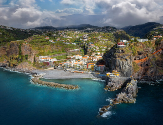
Pico Ruivo is located high in the mountains above the town of Santana.
As with many of the hikes we did, the drive to get there from our home base in Ponta do Sol was a big part of the adventure. In order to get to Santana, we had to drive through Ribera Brava, then head north across the centre of Madeira, through Serra d’Agua, which is drop dead beautiful. Towering walls of terraced green mountains interspersed with wispy clouds moving in and out and through the mountains, which are dotted with red clay tiled homes, make it like driving through a really nice postcard.
That route led us to Sao Vincente through a series of tunnels, which then led us to Boaventura. At that point, we headed onto a road carved out along the side of the mountains and wound us up along one side and out the other side of the valley into Sao Jorge. If you plan to do this trip, exiting the tunnels along the northern coastline towards Sao Jorge alone make the trip to the trail worth it – the ocean views are spectacular. From there, we would wind our way through several more villages before passing through Santana and up into the mountains for another 20 minutes.
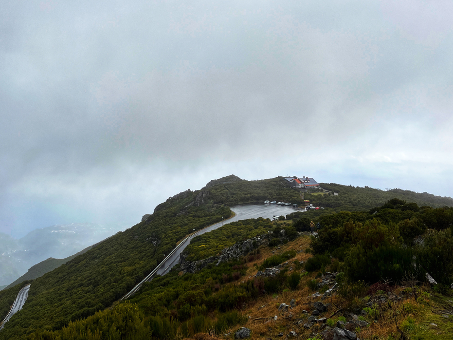
Upon arriving at Achada do Texeira, we were pleased to find a large parking lot with a nice, warm restaurant called Abrigo da Heidi.
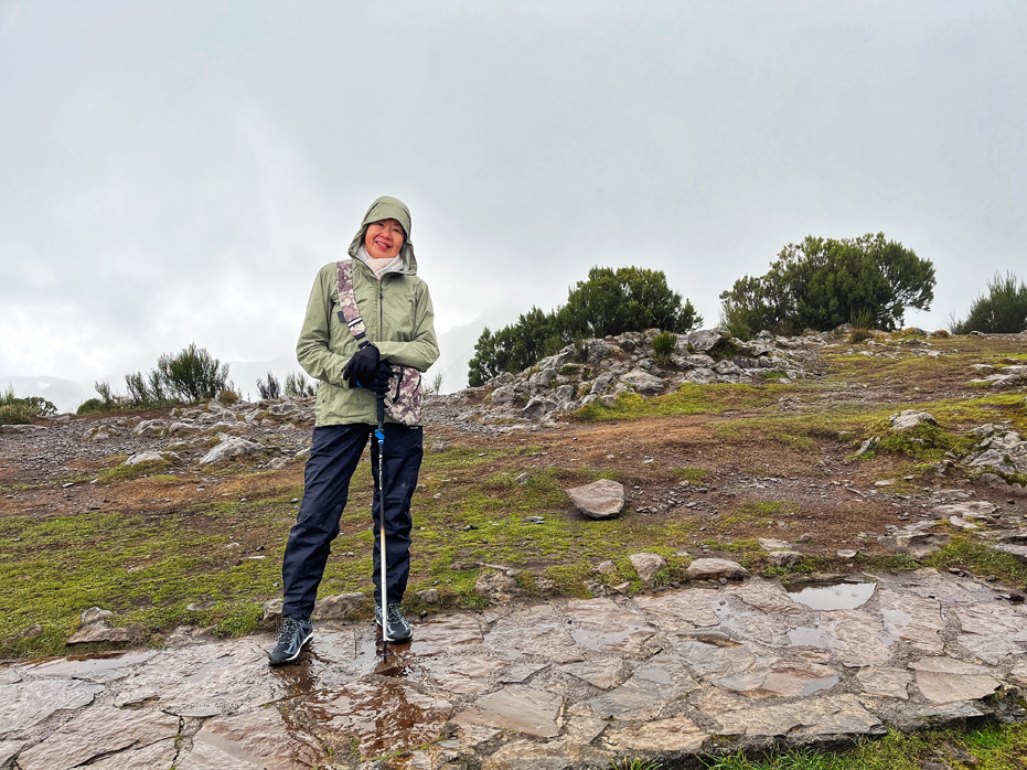
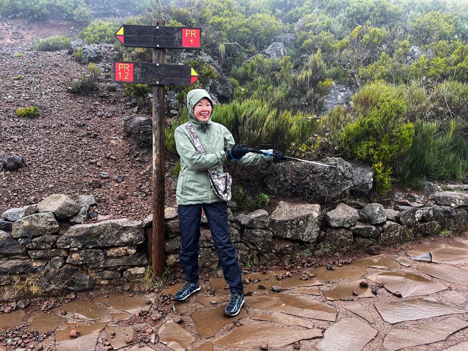
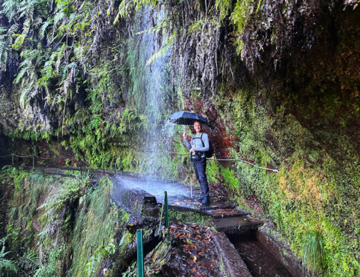
We arrived in the rain and were pleased that the restaurant opened promptly at 9 am and we went inside to have a coffee and change into our rain gear. The cloud cover was quite solid at this point, but my weather app was telling me that it was going to be sunny in an hour or so and we decided to start our hike in a soft, wet rain.
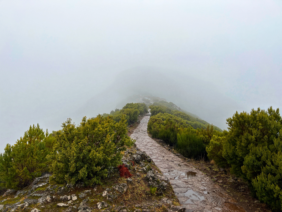
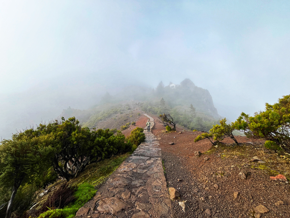
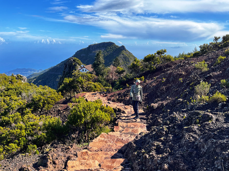
The first section of the trail is a well maintained stone pathway. It was a little slippery due to the rain but we had brand new waterproof hiking shoes, rain jackets, pants and our hiking poles, so we felt okay. The weather was pretty much socked in and we moved slowly upwards through the thick fog. For the first 45 minutes, we could not really see much of the landscape around us, or even the stone resting huts, which kind of appeared out of nowhere irregularly through the mist. It was beautifully eerie.
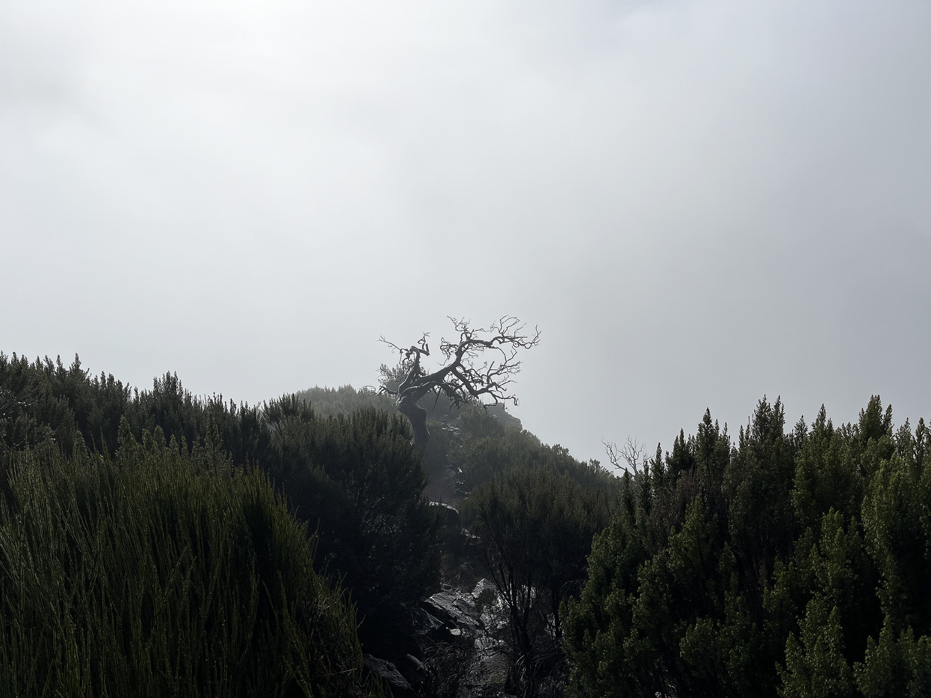
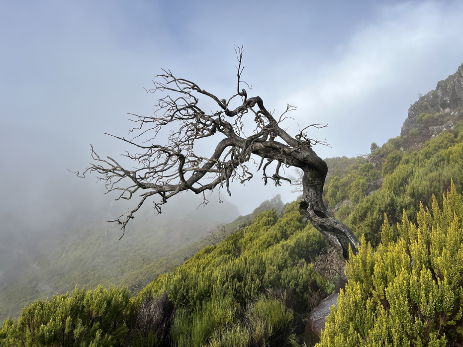
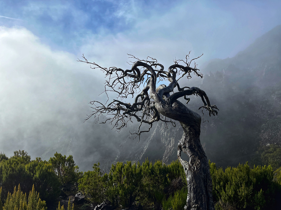
We dubbed it The Warlock Tree.
Then I caught a glimpse of a gnarly old tree down the side of the cliffs and could start to see patches of blue moving northwest towards us, so I was still optimistic that the sun was going to come out.
The single tree was gorgeous and I scrambled down the side of the cliff to photograph it from multiple angles. We dubbed it The Warlock Tree.
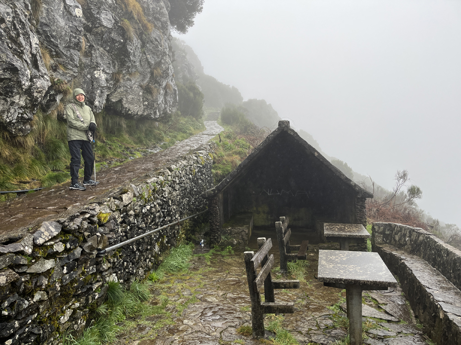
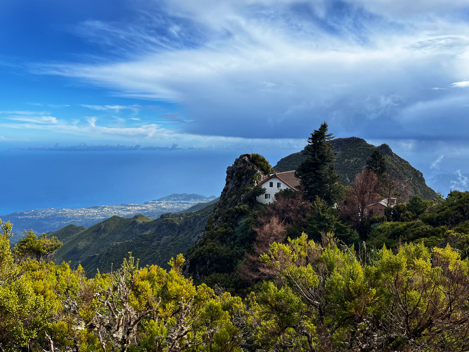
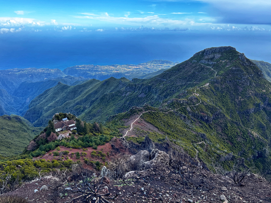
About an hour into the hike, we saw the Casa de Abrigo do Pico Ruivo shelter house above us in the distance. It’s quite a nice rest stop with a large stone patio, table and chairs, and rest rooms inside as well as a series of interpretive signage with overviews and maps of the converging hikes.
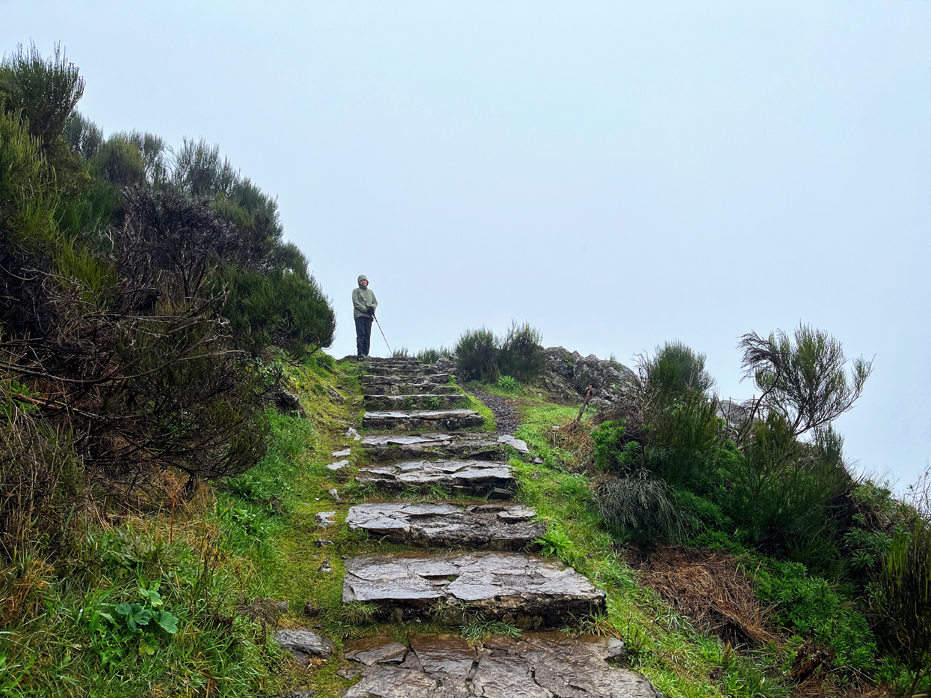
It was nice to stop for 15 minutes, take off a layer of clothing and use the facilities before starting up the last section to Pico Ruivo, which was considerably more challenging than the section we had just completed. The path switches back and forth as it makes its way up.
Starting our hike in the rain and experiencing the clouds clear, watching them be swept over the mountains by the winds from below during our ascent, was magical.
While we were preparing for the final ascent on the patio at the shelter house, the sun came out and began to warm us up quickly. It’s a busy patio – there are 3 other trails crossing at this point that lead to other parts of the island: PR1 – Pico do Areeiro footpath, PR 1.3 – Encumeada, which winds along the central mountain range, and PR 1.1 – the Ilha Trail, so there were hikers coming and going in different directions.
We both looked at each other, Yim gave me the thumbs up, and up we started.
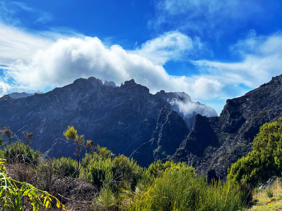
With the sun out, the panoramic views of the island’s mountainous terrain and rich landscapes opened up before our eyes in every direction. Starting in the clouds and experiencing the clouds clearing during our ascent was magical.
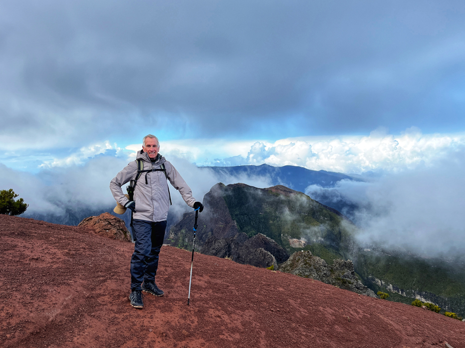
By the time we had made it to Pico Ruivo about 20 minutes later, the sun was (mostly) shining and the clouds that were initially covering the surrounding mountain peaks, had disappeared.
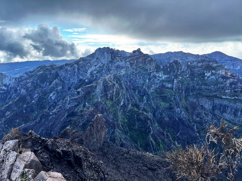
The hike from the Casa de Abrigo do Pico Ruivo shelter house up to Pico Ruivo offers some of the most spectacular panoramic views of the island’s mountainous terrain and landscapes and we stopped on several occasions on our ascent to simply take in the world around us.
With the sun out, we could look back and see the shelter house and the trail we had taken an hour ago and were treated to a view of Santana far below.
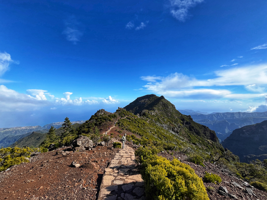
Even as we gained elevation, the pathway was very well maintained, as you can see from the photo of Yim coming up.
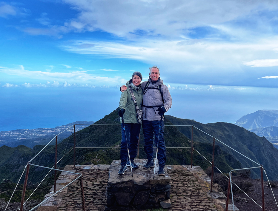
Reaching the summit was a little busy as a group of tourists had arrived during our final ascent and were all scrambling to get to the top in an allotted amount of time so we let many of them pass us.
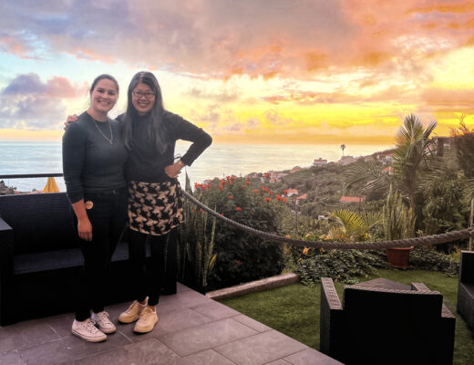
I found, particularly during this trip, that if I see a couple taking individual photos of each other or trying to take a selfie that it is a nice friendly thing to do to offer to take their photo. In return, every one of them will then offer to return the favour, which is how we got such a great photo of ourselves at the top.
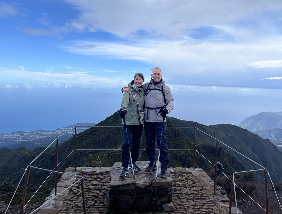
From our perch at the top of the world, we headed back down.
The hike itself is listed as only 5.6 kilometres (3.5 miles) round trip but it’s a steady uphill hike on the way in and with the thick fog and rain, the hike took us very close to four hours, which includes many photo stops along the way. For me, these hikes are to be savoured and we take our time so I can take photos.
If you look at the first photo below, you can see the observation ball at Pico de Areirio in the distance and the craggy outline of our hike from just a few days ago. If you look more closely, you can also see the blackened remnants of the forest fire that swept through the valley below.
If you are a hiker, this is a hike to put on your list. In fact, put Madeira on your list because there are at least a dozen must do hikes on this island.
On our way down, the hike was much easier as the sun was out and the trail was dry. Of course, just as the parking lot came back into view, the clouds moved back in and it started to rain again and we ended up completing the hike in the rain and having our lunch inside Abrigo da Heidi, where visitors are welcome to bring and eat their own lunch.
An hour later, we began the second part of our road trip adventure back the way we came to end another terrific day in Madeira.
If you are a hiker, this is a hike to put on your list. In fact, put Madeira on your list because there are at least a dozen must do hikes on this island.
No Comments