Over a month after being home, the incredible, lush landscapes of Madeira remain lodged in my memory…
This is the most comprehensive post I have ever photographed and written of our travels. It features 20 separately linked posts expanding on the hikes and outings we did. I hope you take the time to enjoy the stories and that they help you if you plan to visit Madeira.
We visited Madeira because we wanted to experience the hiking trails we had read so much about and we wanted to get away from the cold Collingwood weather in January. Somewhere warm but not hot, with comfortable hiking weather. With a daytime average temperature of around 16 º celsius in January, we felt that would be perfect weather to hike the UNESCO-listed forests of Madeira.
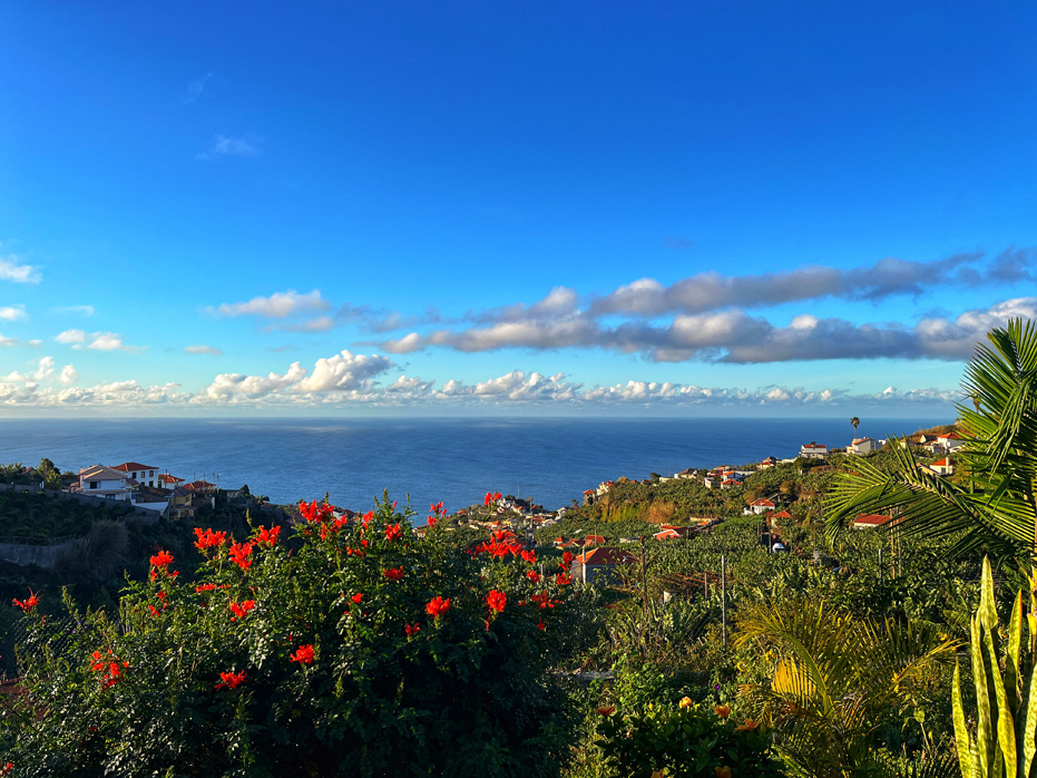
Dubbed the Island of Eternal Spring, Madeira is the perfect place to reconnect with nature and experience the extraordinary.
It is an island blessed with multiple micro-climates, due to steep mountains and valleys. Those mountains, coupled with the warm Atlantic air currents coming from several directions, including the coast of Africa, make the climate different in every corner of Madeira on any given day. However, there are a few certainties; the south side of the island has much lower rainfall and is always warmer and sunnier. Villages such as Ribeira Brava, Calheta, or Ponta do Sol, are sunny almost all year round. That is why we chose to stay in Ponto do Sol.
When you travel to the north, the temperature generally decreases and rain fall is more likely, while in the centre of the island, in the higher elevations, temperatures tend to be lower still, with increased precipitation. The northern regions of the island are greener, more lush and wilder.
In other words, if you like, you can experience whatever weather conditions you prefer to be in on any given day by doing a little traveling around. As an example, on several occasions we would come back across the middle of the island to a completely different day and could see the clouds stalled within the mountain ranges above us. Visually, this was stunning.
The Madeira archipelago is located 1,000 kilometres off the southwest coast of Portugal, and 700 kilometres from Morocco, way out in the middle of the Atlantic Ocean.
Since returning home to Collingwood, someone asked me how big Madeira was. I had no answer when they asked if it was as big as Vancouver island so I did a little googling. Vancouver Island is 39 times larger than Madeira. Prince Edward Island is 7 times larger and the Island of Montreal, where we were born, is roughly 2/3 the size of Madeira, which really made me appreciate just how small an island it is.
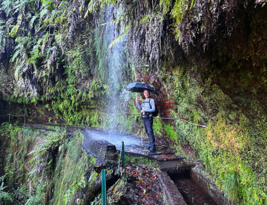
Levada’s and Verada’s
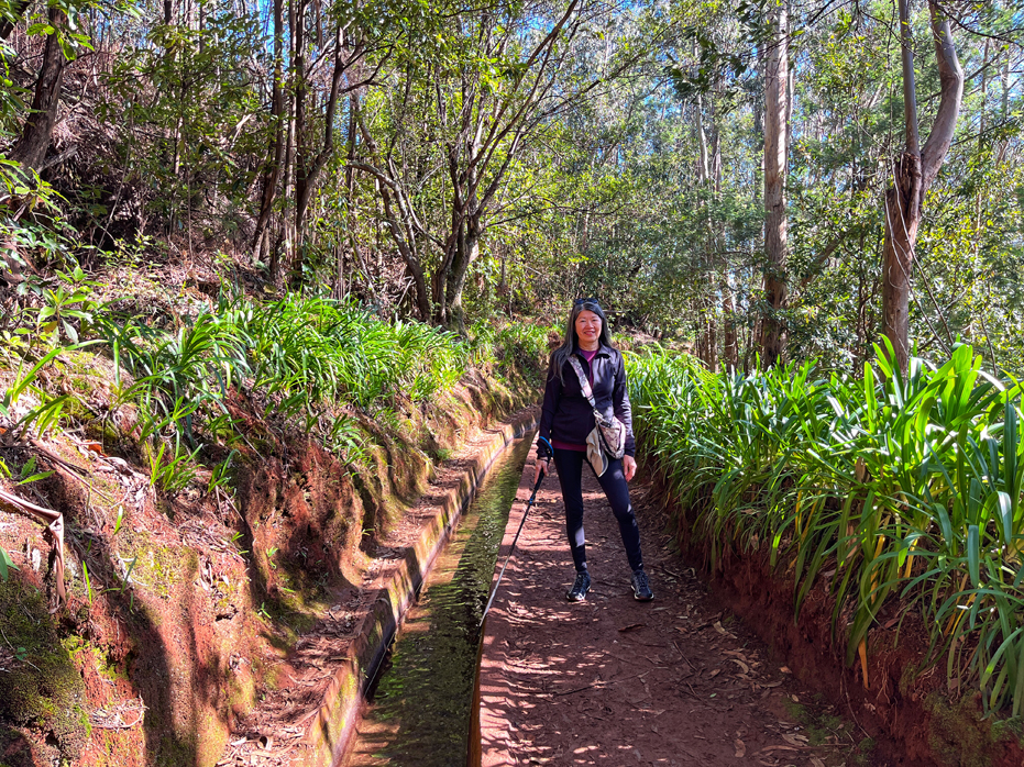
In Madeira, there are two classifications for Hiking Trails; A Levada, which denotes a path with the presence of a narrow irrigation watercourse, or a Verada, which is also a path. but without the presence of water.
In the 15th century, islanders on Madeira created a system of stone channels known as Levadas (from the Portuguese verb “levar” – to carry), to transport rainwater from the mountains to the towns, villages, and crop fields below. Stretching over 3,000 kilometres across the island, the original paths beside these waterways are now very popular walking trails, crisscrossing its otherwise inaccessible, remote areas.
After considerable research, our plans were to attempt 12 trails in 18 days. Some of those were Levada’s and some were Verada’s. The term PR at the end of a trail denotes Pequena Rota (PR), which translates as ‘Small Route‘ or shortcut, and there are 23 Pequena Rotas on Madeira, nine of which are Levadas. Each hike listed below has a link to a full review post.
Our Levada Hikes
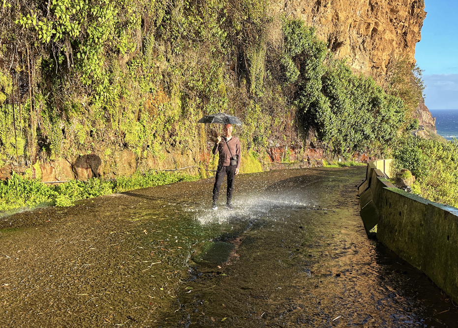
• Levada do Moinho. Our first full day and our first drive to the trailhead was an immediate eye opener to driving in Madeira as we twisted and turned through a series of VERY narrow streets, some with rather extreme inclines, before we found the one way street leading to Igreja da Lombada Church and parked along the street, popped open the hatch and got ready for our first hike. However, this hike was much more difficult that what we had read and if you are attempting this hike, I suggest you read my linked post.
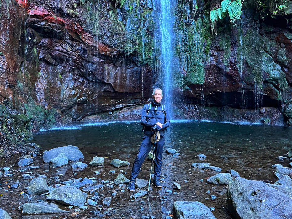
• Levada dos 25 Fontes – PR 6. Situated in the heart of the dense forest that surrounds Rabacal, the Levada das 25 Fontes is Madeira’s most popular Levada walk for good reason. The trail is wide and flat and leads to a stunning series of 25 waterfalls, which all flow over the cliffs into one central pool. We really enjoyed this hike.
In the 15th century, islanders on Madeira created a system of stone channels known as Levadas (from the Portuguese verb “levar” – to carry), to transport rainwater from the mountains to the towns, villages, and crop fields below.
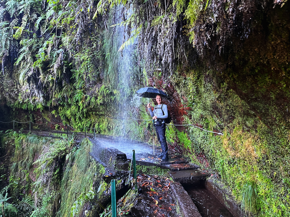
• Levada de Rei – PR 18. Levada do Rei, sometimes referred to as the Kings Trail, is an easy in and out, 10 kilometre hike, which took us 4 hours, including a lunch break. The trail begins just outside Sao Jorge and leads all the way to the source of the Levada, deep within the Laurissilva forest, the Ribeiro Bonito River. This is a beautiful hike.
• Rota do Banana – RB 1. Madeira may be renowned for its hiking and breathtaking landscapes, but it is also a major banana producer. The south coast, where we stayed, is adorned with banana plantations, and Madalena do Mar boasts the largest one on the island – Rota da Banana – where we spent a delightful 90 minutes wandering through a maze of plants. What makes this experience special is that you are able to wander freely through the banana plants.


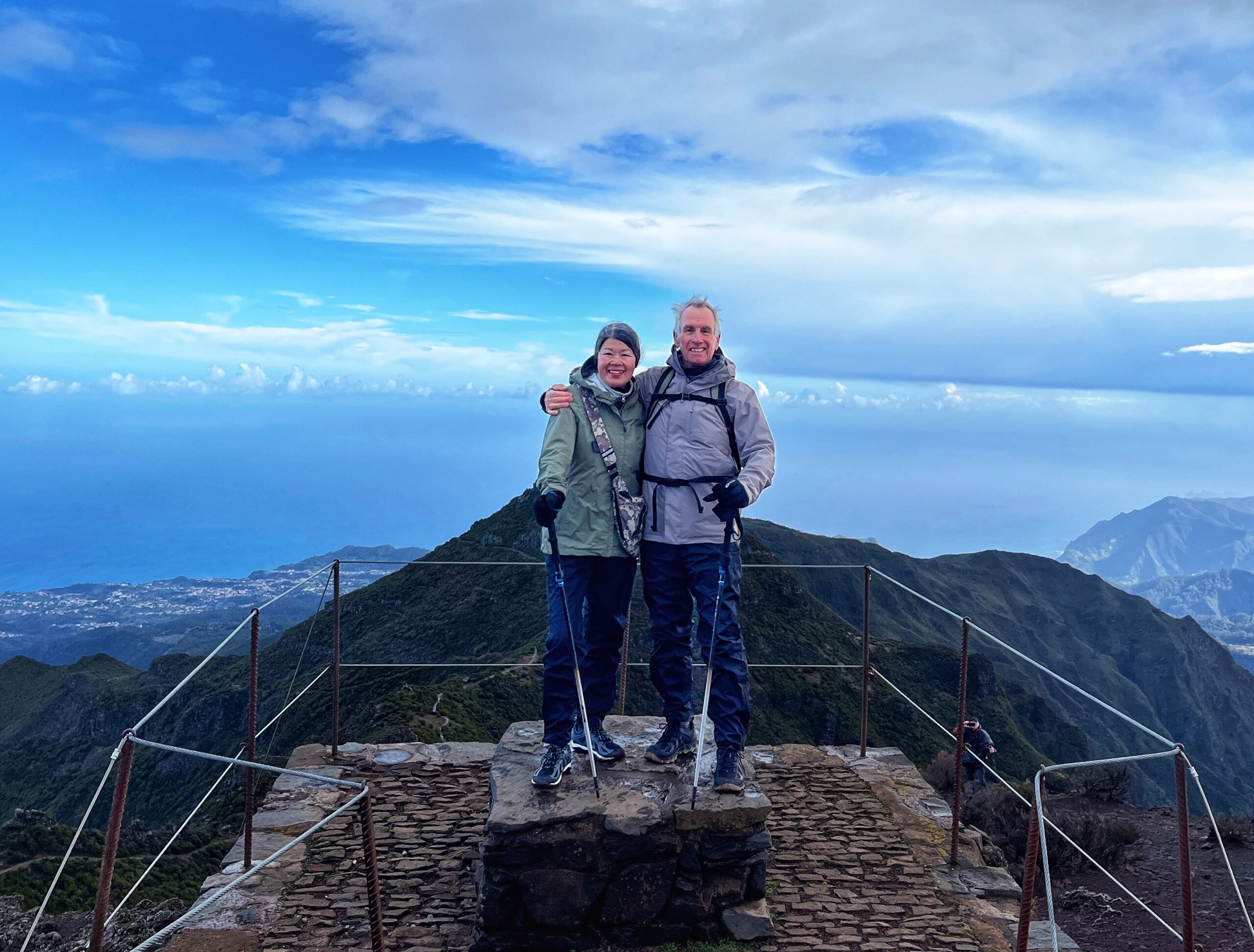
The Summit of Pico Ruivo
Our Verada Hikes
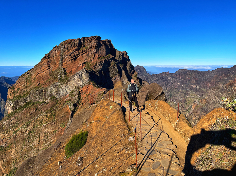
• Pico Arieiro – PR 1. Pico de Arieiro was the most scenic and impressive hike in Madeira for me and although it is surrounded by exhilarating beauty, it would also be a physical challenge for most people. You should be in fairly good shape to attempt this trail. Besides the breath-taking landscapes, the trail is impressive with the exceptional work that the locals put into maintaining it. I could have hiked this trail several times and seen something different on every visit.
• Achada do Texiera to Pico Ruivo – PR 1.2. This hike is an emblematic Madeiran trail and leads to one of the island’s highest peaks: Pico Ruivo at 1862 metres (6000 feet). On our hike, we were treated to all the weather conditions as we began in the rain over the mountains, watched the sun come out and open up views of the valleys and then close back in for the end of our hike. It was magical 🙂
Dont miss The Witch Tree of Fanal, Pico Arieiro, particularly the Stairway to Heaven or Pico Ruivo. These are once in a lifetime places to see.
• Vereda da Ponta de Sao Lourenço – PR 8. Often referred to as ‘The Dragons Tail’ trail, Vereda da Ponta de Sao Lourenço leads you along a narrow stretch of rugged coastline along the far eastern tip of Madeira with beautiful views of dramatic cliffs and ocean vistas in every direction. At 7.5 kilometres in and out, this trail can be enjoyed along a well maintained stone walkway. Round trip for us was just about three and a half hours.
• Verada dos Balcoes – PR 11. Located in the Ribero Frio Forest Park, this is the perfect trail if you are looking for an easy 3 klm hike. The highlight of this hike is the Balcões Lookout, with views of the highest peaks of the island, Pico Ruivo and Pico Arieiro, as well as the valley of Ribeira da Metade, the town of Faial and the breathtaking spectacle of Penha d’Águia on the horizon.
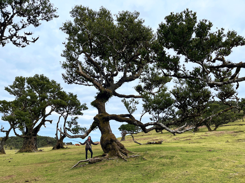
• The Fanal Forest – PR 13. The Fanal Forest is unique in that it is one of only three places left on Earth home to a Laurel forest, also called a laurisilva or laurissilva forest, a type of subtropical forest found in areas with high humidity and relatively stable, mild temperatures, such as the highlands of Madeira. Plus it’s got that Witch Tree…
Miradouro’s
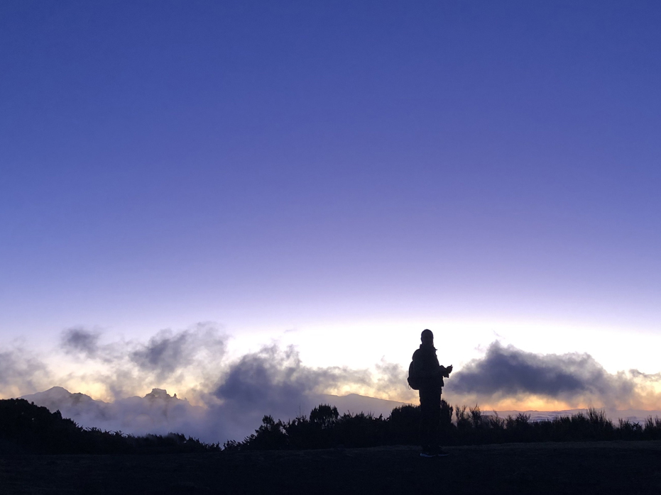
What we had not really considered properly before we arrived were the many Miradouro’s on the island. Miradouro’s are viewpoints with spaces to sit and rest and they are scattered all over the island, usually located at the highest points of the particular hill or mountain they are located on. While I had read about them them, I had no frame of reference for them. The only Miradouro I knew we would visit was Bica da Cana at sunrise, as I had found several well written descriptions and absolutely gorgeous photographs of the sunrise there.
By the end of our three weeks, it was the Miradouro’s that we wanted to visit. By that point, we had completed most of our hikes and were becoming quite familiar with the island so we knew what we would be looking at by the location of the Miradouro.
Here is a list of the Miradouro’s we did visit and links to my posts of each.
• Miradouro Bica da Cana. Located at an altitude of 1580 metres (5,125 feet), Bica da Cana is the perfect Miradouro to experience the sunrise. This was the highlight of our trip for me.
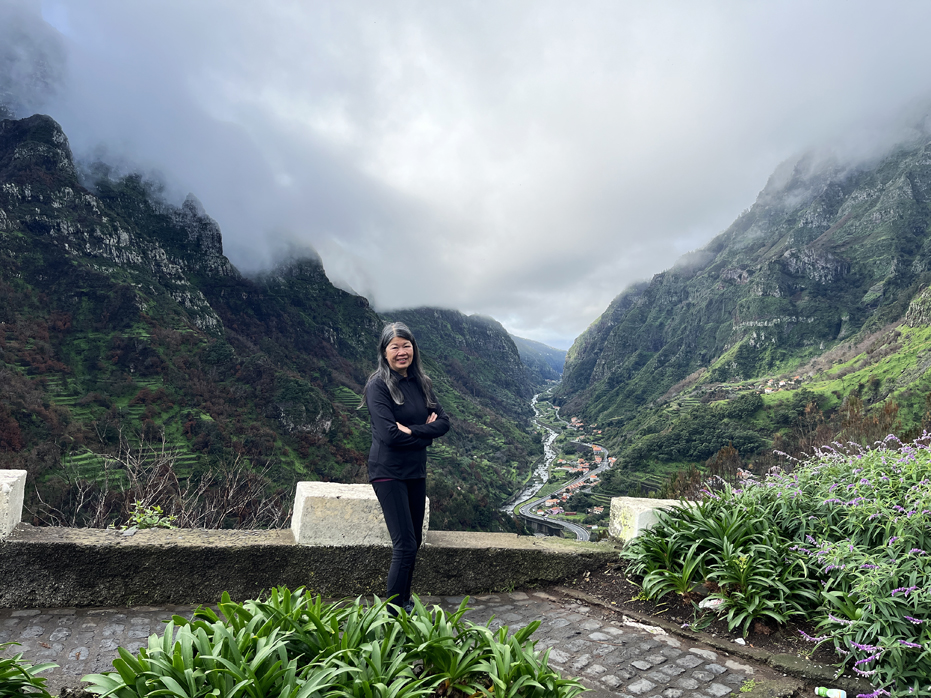
• Miradouro Terre Grande. Miradouro de Terra Grande was one of the most spectacular views in Madeira, with its breathtaking view of the valley and the Atlantic Ocean in the distance. If you are visiting Madeira, make sure you take this detour to visit.
• Miradouro Guindaste. Miradouro do Guindaste is located on the northeastern coast of Madeira Island, within the municipality of Santana. While writing this, I am reminded that we were so busy visiting other spectacular locations scattered across Madeira that it took us three weeks to visit this spot. If you are planning a visit to Madeira and love photography, don’t miss this spot.
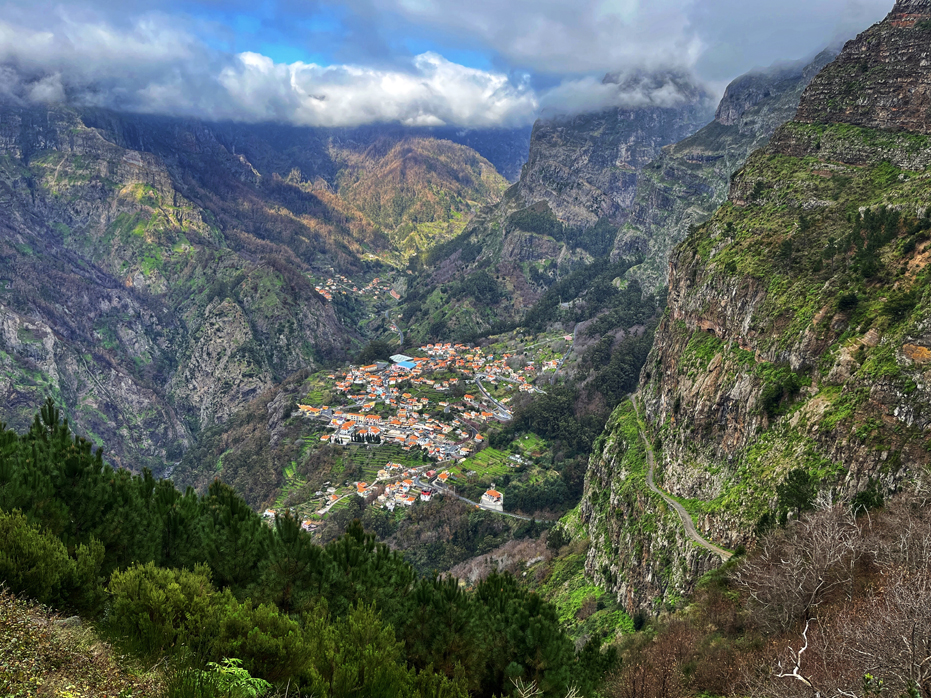
• Miradouro Eira do Serrado. Curral das Freiras, otherwise known as Nuns Valley, is a tiny little town located in the heart of Madeira, completely surrounded by steep mountains on all sides. The town earned its name for being a sanctuary and hiding place for the nuns of the Convent of Santa Clara during pirate attacks. Nestled deep in the mountains of Madeira, this village is almost completely hidden from the outside and was nearly inaccessible during the 16th century.
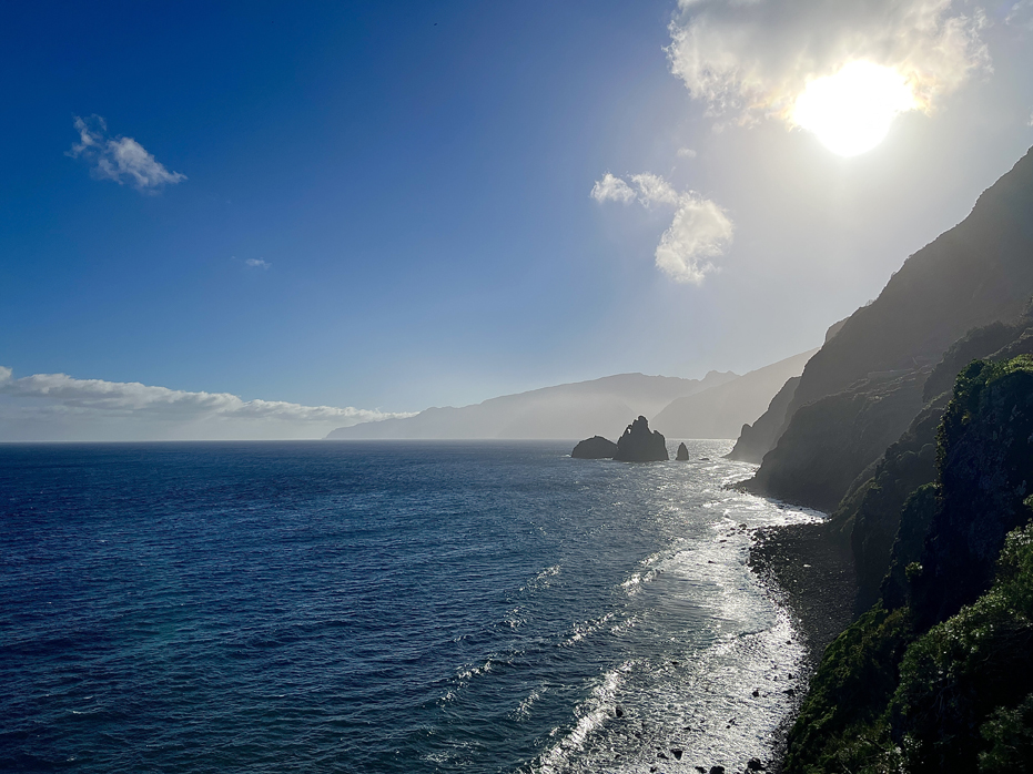
• Penha d’Águia. Geologically, Penha d’Águia stood out as one of the most impressive features on Madeira to me. We first noticed it while scoping out Levada do Larano as a potential hike we could do. While up in the mountains to the east, it started to rain and a rainbow appeared over the ocean and behind us. We both turned around and there it was, arching over this immense green boulder in the distance. It is so fantastical !
• Cabo Girao. This is a popular lookout on the island and we did take the time to go visit, because of the hype we read. We were completely disappointed. It is certainly not worth the $3 Euros per person to walk out onto the small glass bottom lookout. Not only that, there are several tourist traps here where a t-shirt we bought for Grace in Funchal for $7 Euros was $17 Euros here. It’s a complete rip-off as buses offload tourists from the cruise ships on a day outing. Go and visit any of the other free Miradouro’s on the island.
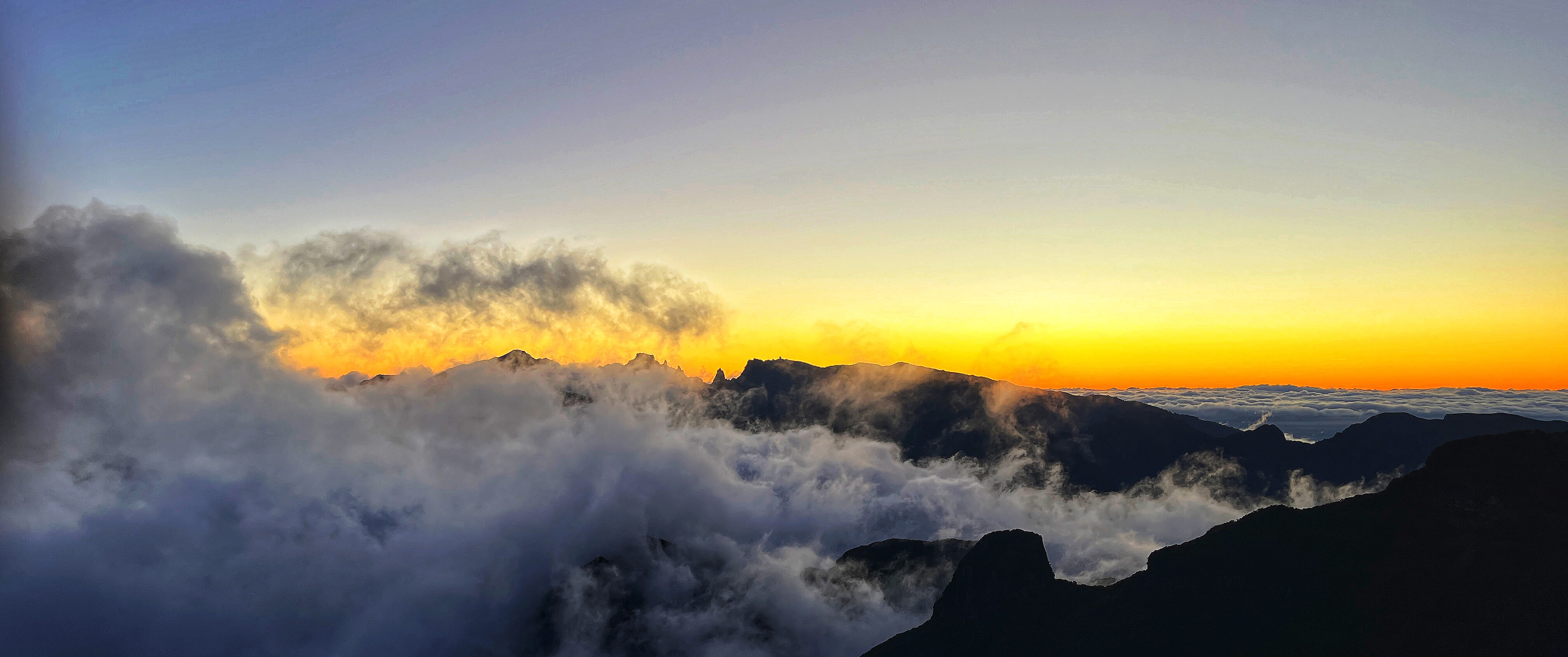
Sunrise at Bica da Cana
A Few Other Highlights
Madeira was absolutely one of the best trips of my life. The island is beautiful, the people were friendly and were genuinely pleased when we would try to say anything in Portugese, even if only the simplest of terms like ‘Obrigado‘, which, of course, means Thank You.
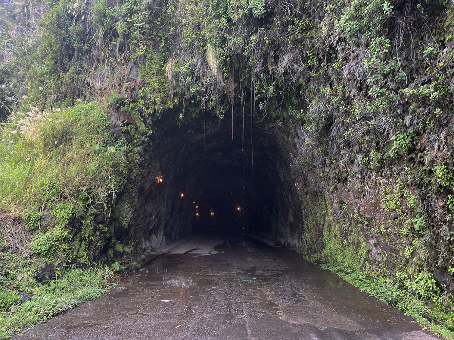
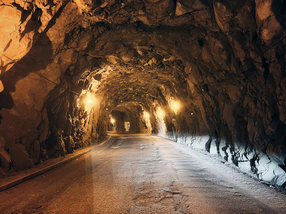
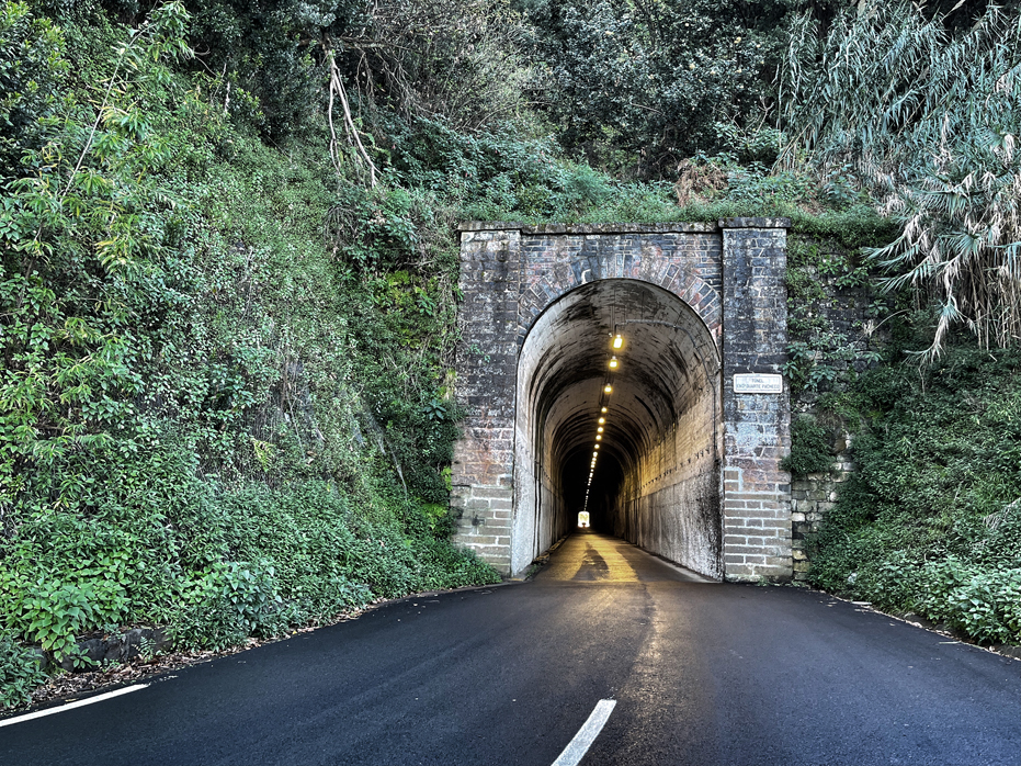
The roads were exceptional for an island and the Tunnel Network astounded me. I was impressed to the point of distraction with the feats of engineering that went into the infrastructure of the transportation network of Madeira. They’re well maintained, well marked and easy to navigate. Without the tunnels, travel would be almost impossible.
For centuries, Madeira’s rugged landscape made travel between villages and towns arduous. Steep cliffs, deep valleys, and dense forests often forced residents to rely on narrow, winding paths carved into the mountains. In the 20th century, Madeira began constructing tunnels to improve connectivity and enhance infrastructure.
The island boasts an impressive network of over 150 tunnels, ranging from short passages to 3 kilometre long tunnels.
Together, they are part of an expressway road network that circles the island and not all of them are straight and flat, some have have steep internal climbs or descents, tight turns and even some exits.
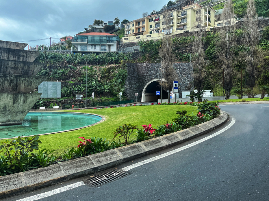
Ponta do Sol is home to several of the coastal tunnels, seamlessly connecting the town to other parts of the island and are a perfect example of Madeira’s blend of functionality and scenic beauty, as they feature glimpses of the Atlantic Ocean as you pass through them. The tunnel exiting Ponto do Sol at the central roundabout is shown at far right below.
A few of the old coastal road tunnels are quite foreboding, as the photos below show, and for me, completely enticing. As we were entering the first tunnel shown below, Yim said to me, “Are we sure we want to do this?”
And the walkways and staircases between houses within neighbourhoods completely amused me as illustrated on my Cantinho do Sol post.
A few other things we did…
• Cascata da Onjos. Cascata dos Anjos is a waterfall which cascades over the old coastal highway located in Ponta do Sol, close by to where we were staying. This is very worth doing on a hot day.
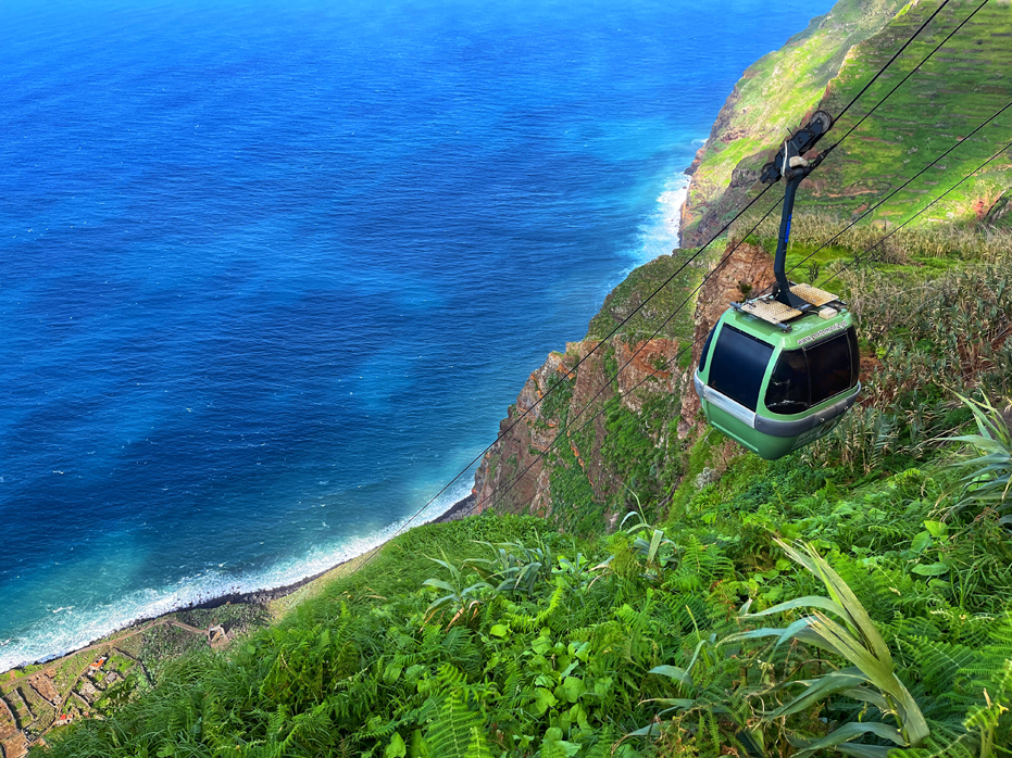
• Achada da Cruz Cable Car. One of our day trips was a visit to the Achada de Cruz Cable Car, located on the northwestern coast, which transports visitors 1,500 feet down the cliffs to one of Madeira’s Faja’s. The cable car, costing just $3 Euro per person, claimed to have a vertical drop of 98 degrees, the steepest drop of any cable car in Europe and I thought it would be cool to give this a try. It was !
• Ilheus da Ribera de Janela. The name Ilheus da Ribeira da Janela translates to Islets of the Janela River, which is the river you will see running into the Atlantic Ocean. We spent about a half hour here, wandering unsteadily along the beach rocks and enjoying the sunshine before heading back towards our car, where we headed off to Porto Moniz to have a swim in the Lava Pools and lunch.
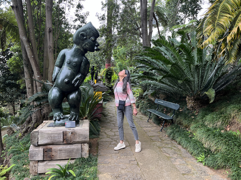
• Monte Palace Tropical Gardens. One of the most well-known attractions in Madeira. Covering an area of 70,000 square metres, this gardens contains a variety of botanical species, from African cycads to American sequoias, Asian camellias and azaleas to the ancient olive trees of Alqueva. My favourite part was the Oriental Gardens and the sculptures dotted throughout the gardens.
Where We Stayed
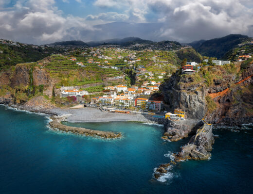
Ponto do Sol. Nestled between steep hills and the Atlantic Ocean, the picturesque town of Ponta do Sol was a nice spot to enjoy some quiet time away from a cold January in Collingwood. The charm of the pebbled beach that lines the waterfront promenade and the pastel buildings along the palm-lined street, give it a serene little village vibe. Located 45 minutes from the Madeira airport, it allowed us pretty easy access to the entire island.
My post provides some nice detail on Ponto do Sol and the restaurants we enjoyed during our visit.
And of course, I have saved the best for last – our home away from home, Catinho do Sol.
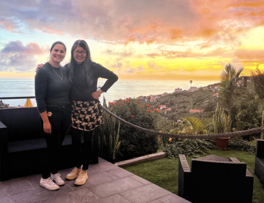
An absolute gem situated high up in the valley with spectacular views of the Atlantic Ocean and the village below, Catinho do Sol was the perfect place to enjoy our three weeks in Madeira.
It was well furnished, with a nice living room & dining area with streaming music or Netflix if we chose, which was nice. Rita had pre-set the music to a smooth station, which we enjoyed our entire stay. The bedroom was comfortable and the twin doors opened up onto a beautiful view in the morning and on warm nights, we left the door open and the metal blinds in place to allow the cool air in. The washroom was clean and had a nice separate shower. The kitchen had excellent appliances and pretty much everything we needed.
If you are considering renting a small home while visiting Madeira, we highly recommend Cantinho do Sol.
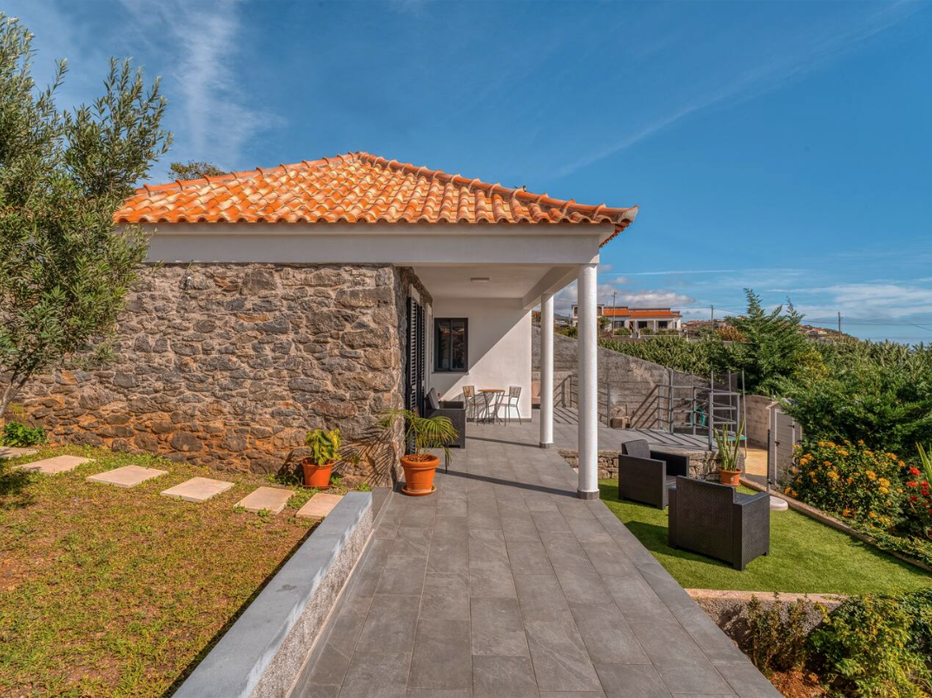
Cantinho do Sol
A Few Recommendations.
Hike early or hike late. There are many wonderful hikes to enjoy on the island but most of them are along Levadas, which are irrigation systems. These paths are not wide and the hikes are generally not loops. I would recommend hiking early or later in the day, not only for the weather, but to avoid most crowding.
Collect viewpoints. Madeira has set up Miradouros almost everywhere. It was absolutely fantastic to be driving along a road with magnificent views and find a spot where we could pull off, park and take the time to enjoy it.
Wake up early to see the sunrise. We only did this once at Bica da Cana and it was spectacular. It I were on the island for three weeks again, I would get up at least once a week for the sunrise, weather permitting.
Carry cash and change. If you want to stop and check out a small town during your travels, there are parking metres in most small towns and change comes in very handy.
Go up into the Madeira mountains. Madeira, at least for me, had very little to do with the coastline except to use it as a feature in some of my photographs. The interior of the island was where it was at for me. The middle of the island consists of jagged peaks that are magnificent. From some of these mountainous trails, you can see the sea on both sides. Get as high up into the mountains as you can, several times.
I hope that my photography entices you to visit and that this post helps you plan your trip to Madeira
No Comments